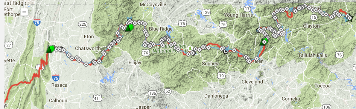
In April I made an attempt at riding the TransNorthGeorgia mountain bike route. The ride was cut short on the second day after only covering about a third of the distance. The big take-away at the time was the the route was extremely vertical and required excellent physical shape and proper gear tuning/fitting to complete.
I made the decision shortly after coming back from the bailout that I would sign up for the official race, nearly four months away at that point, and complete the ride from the start.
The [not] Prep
I felt good after that first attempt, probably because I was coming off some good fitness from riding a lot earlier in the season, so even though I had experienced what the route could dish out, I took a rather lackadaisical approach to training any further… that is to say, I didn’t.
In the four months between attempts, I rode my bike for more than 30 miles at a time exactly five times. I’d basically trained for a marathon by jogging to my mailbox less than a half-dozen times.
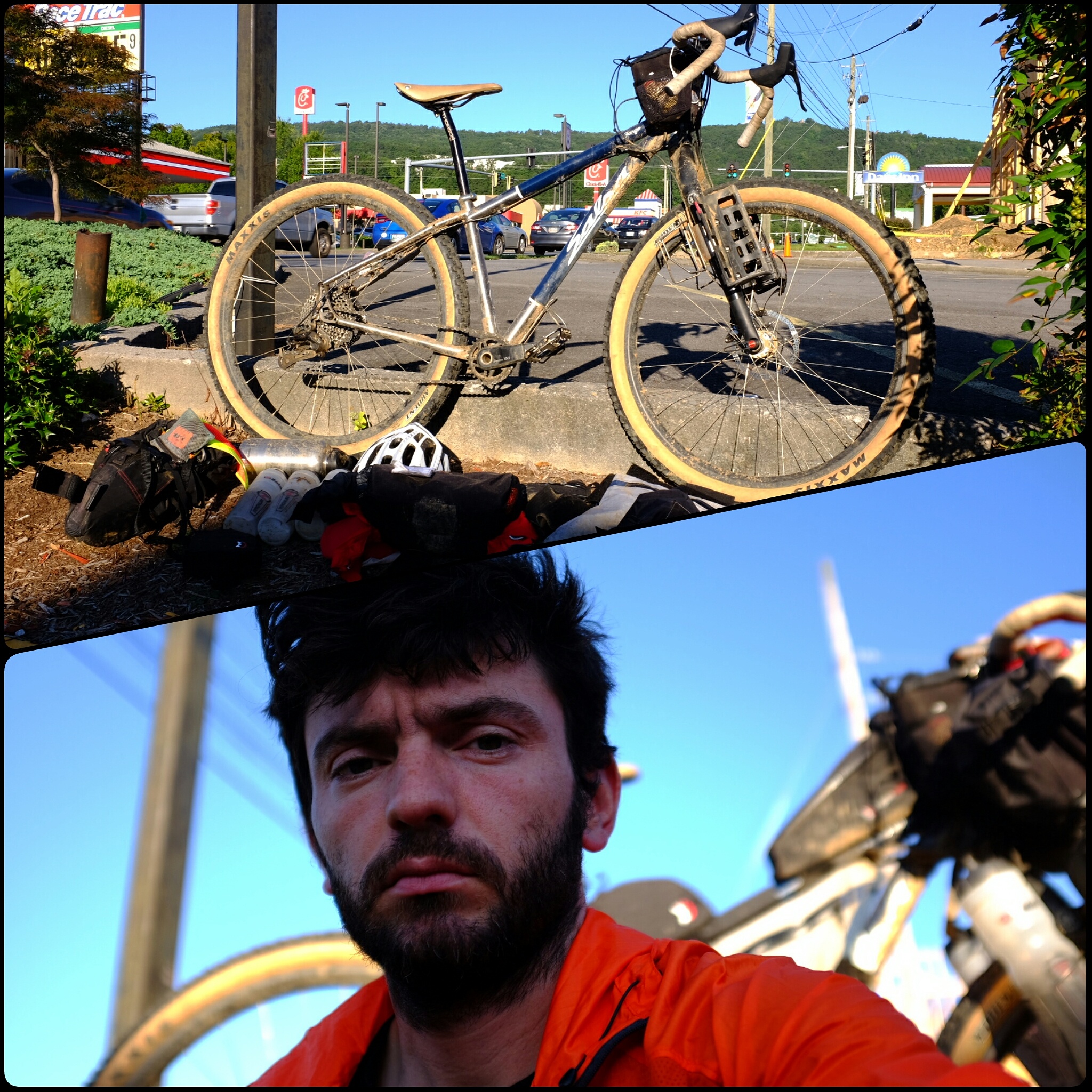
As far as my gear and bike, that seems to be for the most part, dialed in. Now, what I pack and how/where I pack it on the bike is a whole different matter. I’ll typically spend on the order of two days with everything kinda spread out in the living room, debating with myself over the best sequence to pack things on the bike.
The final thing I just didn’t put any thought into (because it worked so well in Florida… because I planned and prepared) was food. I made nothing prior to the ride. I just stuffed my bags with bars and other homogeneous foods.
So now that I’m thoroughly unprepared, let’s get to the ride.
The Ride [Day One]
My plan, had been to repeat the process from April, to drive up the night before departure and camp at or near the start line bridge. My ride was more inclined to sleep and drive me up in the morning. So while I got an extra night of sleeping in a bed, it only lasted until 4:30a and was followed by dragging gear down to the car, and a two hour car drive (not ride).
At the start, I got to chat with a bunch of my fellow riders. Many, like me, seemed to not have fully accepted the gravity of the thing they were about to do. We all handed in our waivers and powered up our GPS’s and, in true mountain-biking form, we rolled out for the 8am start at around 8:20.
There’s one disadvantage to riding in packs at events like this, the start is always way too strong. Everybody gets together, they’re all fresh, and no one wants to be seen as the guy who’s just dragging 5 miles into something, so everyone just hammers like they’re riding some afternoon loop to the coffee shop.
Try as I might not to get caught up in this, I almost always do. But I’ve gotten a lot better at recognizing it sooner and backing down before I do any real harm to my ride as a whole.
Once I backed off a bit, and started reviewing what I knew of the course in my head, I was able to get into a nice rhythm and roll through a lot of the early stuff without issues. Riding at the end of Summer instead of close to the beginning of Spring meant more heat, but it also meant that all the thaw runoff was gone, so instead of crossing dozens of little mountain streams, there were only the few, larger ones to deal with.
My goal, since sitting down with the route on paper was always to try to make it to the top of Tray Gap on the first day. I knew I could do the ascent in the dark with my lights so I didn’t mind if it took me all day to get there. Talking with other riders, a lot of them set goals of making it over the gap, down through Helen and over the next two big climbs to Vogel State Park in the first day. Some simply wanted to get to Helen so they could hotel it. As the day wore on, I felt good and, more and more, I toyed with this idea of keeping my momentum going and pushing into Helen or beyond. Vogel was just 3 miles shy of where we bailed on the last attempt after two days, so to make that in just one seemed like maddening ambition!
Ultimately, the decision was made easier for me by Nature. On the long climb up Tray, lightning started to help illuminate the mountain. By the time I got to the top it was starting to sprinkle just slightly. The two guys I had been riding with started to descend and I promptly pulled off, satisfied that I had made it to the place I originally set out to make it to, and satisfied that descending the next section, in the dark, during a storm, was probably a less than ideal proposition.
Ride stats: 86 miles, 13,000 ft, 13 hours
The Ride [Day Two]
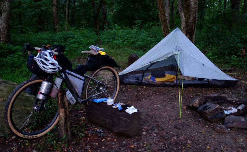
I woke up just before sunrise to the sound of a rafter of turkeys not far from my tent, and a small mouse who had gotten into the bar wrapper I left in the mesh pocket on the outside of one of my bags. Everything was soaked, hours of heavy heavy rain had just drenched the world around me. This was the first time I’d been able to use my Zpacks tent, and it worked flawlessly. I only used one of the two storm flaps on it and still remained dry and comfortable all night.
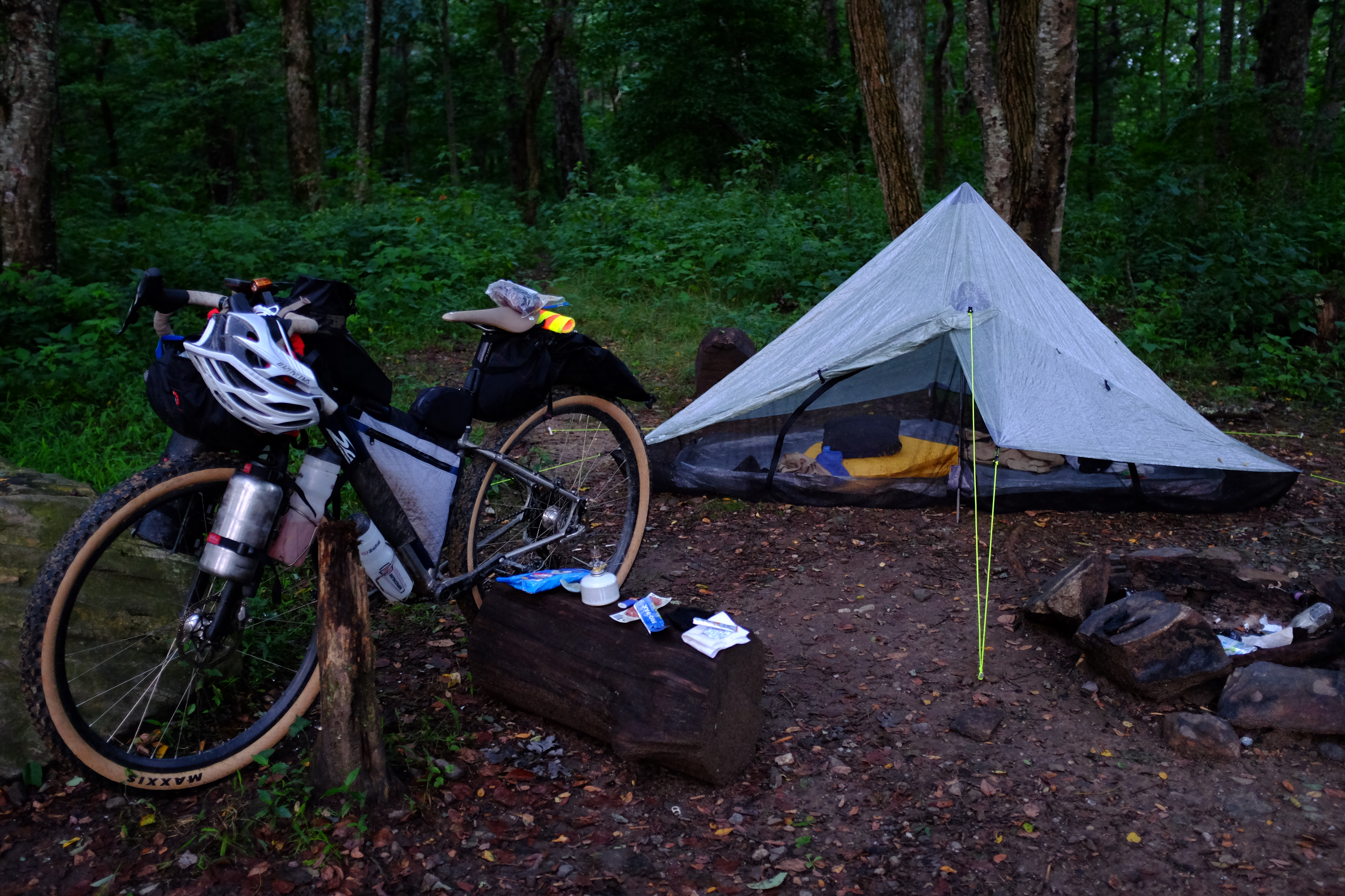
After coffee, breakfast, and breaking down camp, I was ready to bounce down the Hickory Nut Trail into Helen. In the Spring, this trail had been overgrown and littered with loose ‘babyhead’ rocks. I think it’s good that I rode it then, because riding it now was almost a cake walk by comparison. The couple dozen riders who’d gone over it the day/night before had pretty much cleared it out. It was still gnarly but I didn’t feel like it was something I was zonked after completing. The one casualty of the descent was my rear brake, which faded away into uselessness (that’s ok, the front one is where you do most of your braking anyway).
I made a quick pit into Woody’s bike shop outside Helen to get water and then continued on towards the first big climb of the day, Hogpen Gap. I made it just passed the start of the 7+ mile climb when the sky opened up again. Biblical rain. 100ft visibility sort of rain. The rain finally let up to just a steady soaking by the time I reached the top. There I found five guys huddled under the hiking billboard at the trail crossing in the parking lot. They were waiting for the rain to pass before attempting the descent down the other side. I was in no mood to stand in mud and wait maybe two hours for rain to finally completely end. I also knew that these storms were moving east, and the route moves west, so the best way to get the storm to pass was to ride through it.
The last time I descended this road on a loaded bike I think I hit something like 46mph. The sting of the rain and lack of ability to keep my eyes open held me to around 35mph this time. After this descent I knew the road turned to gravel, there would be a deep creek crossing and then some very steep climbing for a while, so I decided to stop, dry off my feet, and put on a fresh pair of socks after the creek.
What I forgot was that there was a second creek, shortly after the first, so that exercise was ultimately a waste of time. In hindsight, I could have stopped, taken off the dry socks, crossed, and re-dried my feet, but these aren’t decisions that come naturally when you’re completely soaked and have been putting your body through a gauntlet for the last 30 hours. Also, the rain had stopped, so I figured I’d dry out soon enough.
The climb up Wolfpen Gap was blanketed by a thick, video game fog. That eerie fog that somehow silences most of the sounds of nature with its presence. The one thing it didn’t silence was the angelic singing that (I hope) was coming from the lake below. The notion that I was ascending into madness came foremost to my mind as I struggled to figure out if the music was real or just a hallucination. Ultimately, I decided that knowing the answer wasn’t going to help me any, and the sound was really quite beautiful, so I just relaxed (as much as you can on 10%+ grades) and let the angels sing me up the mountain.
Uncharted Territory
After the top of the paved Wolfpen Gap, the road becomes dirt and continues up. I knew that after the top of this, the next big climb wouldn’t be for a while and could only hope that the descending and ‘flat’ sections were smooth and clear and I could have some ‘recovery’ miles before one of the sections I had been dreading since I started looking at the route, Aska/Stanley Gap just south of Blue Ridge.
There was a short section of descending, then a small climb, at the top of which I passed (what I assume was) a convoy of Army Corps of Engineers who were at a standstill, presumably having something to do with the truck with an open engine hood. I briefly thought they might be there to support the race in some capacity, then I quickly figured they were probably just surveying damage from the previous night’s storm.
The only real ‘support’ they provided the race was to have created wonderful large truck trenches in the mud of the road I was about to descend for several miles. Once again, a spot on the course which could have been fun/chill, is brought into the realm of butt-puckering by degraded surface conditions.
This bit drops down to Hwy 60 and Cooper Creek Road, where there is a little store that had been cleaned out of sandwiches, but still had some chilidogs. I’d been craving sandwiches, but I can never say no to a hotdog. I’d also been struggling with eating the whole race. I was able to force myself to drink, but I just hadn’t been able to make myself consume the calories I knew I should be, so really, anything I could get an appetite for, I was going to try to eat, consequences be damned.
After about half an hour of catching my breath, doing some personal hygiene, and trying to force down some more food, I finally set off to follow the river for a bit on the way up to Aska.
I’d ridden this trail[system] in the opposite direction (on an unloaded, extremely light bike), and doing so had remarked on how hideously impossible it would be to ride the other way… Turns out, attempting a ‘hideously impossible’ trail with a 48lb bike plus 10lbs of water, doesn’t make it any more possible.
Stanley Gap
Within the first couple hundred yards of starting this trail I was already off the bike. The smaller root ledges towards the bottom of the trail were something I probably could have ridden, if this trail was all I’d been riding that day, but considering I’d already ridden over 60 miles and was planning to ride another 30+ after this, I wan’t going to be a hero.
The trail would tease me with twenty or thirty yards of visibly shallow grade, enticing me to remount the bike, and as soon as I would, it would turn around a bend and kick up to another unrideable section, forcing me to grind to a halt, dismount, and start pushing again. The energy it takes to keep getting off and on the bike was starting to take it’s toll.
This portion of the route is only 5 miles long, but it took more than 3 hours to complete.
I remembered there being a huge rooty rocky ledge somewhere near the top, so I kept my eyes out for this as my marker for when the suffering might come to an end. I passed three such ledges I thought to be the one I was looking for, each getting my hopes up, only to have them beaten down by a trail that continued towards the sky. Finally, I got to the one, it probably took me between 30 seconds to a minute to get my bike up and over this 5ft obstacle.
After a few miles of techincal descending I was back on ‘roads’ for a while. At this point I’d been riding with with two guys, Craig and Brian, for a while and they were low on water. Craig heard something about a school or a church ahead in a ‘town’ called Cherry Log, which is halfway between Ellijay and Blue Ridge near hwy 515. My recon led me to believe that there were no services to be had at 515, and that the closest gas station was about 4 miles, off route, up the highway.
We got to the church, filled up our bottles and asked some of the guys who happened to be there if there was anything closer than the gas station I knew was 4 miles up the road. They said there wasn’t. To our surprise, after crossing the highway, and making a right turn, just before we made a left, the road continued on ahead, back under the highway and not even a quarter mile up was what appeared to be a barbeque joint…
We pulled into the parking lot at 8:30 and saw an ‘hours of operation’ sign that said “til 9”!
Pulled pork, mac-n-cheese, and fries later, we were ready to head up the road.
Our destination was a cemetery near Dyer Gap called, of course, Dyer Cemetery. I had seen the cemetery on a ride a month or so ago so I knew it would be a place to pull over. I had forgotten that there was actually an awning structure there that would offer shelter. I also was under the assumption that this cemetery was at the top of the terrain in the surrounding area so, looking at the mileage, I was preparing myself to climbing, all the way to camp, as I’d done the night before.
Turns out, the top of this particular climb is about 2 miles before the cemetery, so just when I was getting to the point of hating myself for dwelling on how steep the road was and how much further I had to go, it turned down, and I was able to basically coast into camp.
This was the happening spot apparently, there were nearly a dozen riders in total camped out. Most were under the ‘awning’ which turned out to be more of an open-air chapel, complete with pews and a pulpit. Because of the temps, I’d skipped the sleeping bag the night before, and because of the shelter here, I skipped my tent. I inflated my sleeping pad and laid down on one of the pews to get some rest.
About twenty minutes later the guy in the pew in front of me rolls over and begins violently vomiting. My mind is suddenly thrust into panic. Partly because I had placed a water bottle under his pew so I could drink during the night and not worry about kicking it if I had to get up, but mostly because I didn’t want any sort of sympathetic response on my part to bring me to lose what precious few calories I’d been able to get down. I also was stricken with the notion that I might have eaten the same thing as him at the barbeque place.
I covered my ears and hoped for the best.
Ride stats: 100 miles, 13,000 ft, 16 hours
The Ride [Day Three]
I’ve had a long standing tradition of not taking a dump in the woods on bike rides. I woke up in the cemetery with the impending notion of bowel motion. I thought about fighting the urge briefly, then I looked around and saw a big blue box just on the edge of the cemetery in the trees… a port-a-john! Fire up the stove, it’s time for coffee and a poop!
One of the other things I try not to do is wear the same pair of cycling shorts more than two days in a row on rides. So, in addition to my morning cup of joe and my sit down in the hole with a huge wolf spider, I also had a fresh pair of shorts to put on. I had toyed with the idea of putting these on the previous day after the rain stopped, but I knew I still had more than two days to go and drying out bike shorts on the trail is next to impossible. I was starting to get pretty raw down there, so I slathered on some Bacitracin and slapped the new shorts on and set off down the mountain.
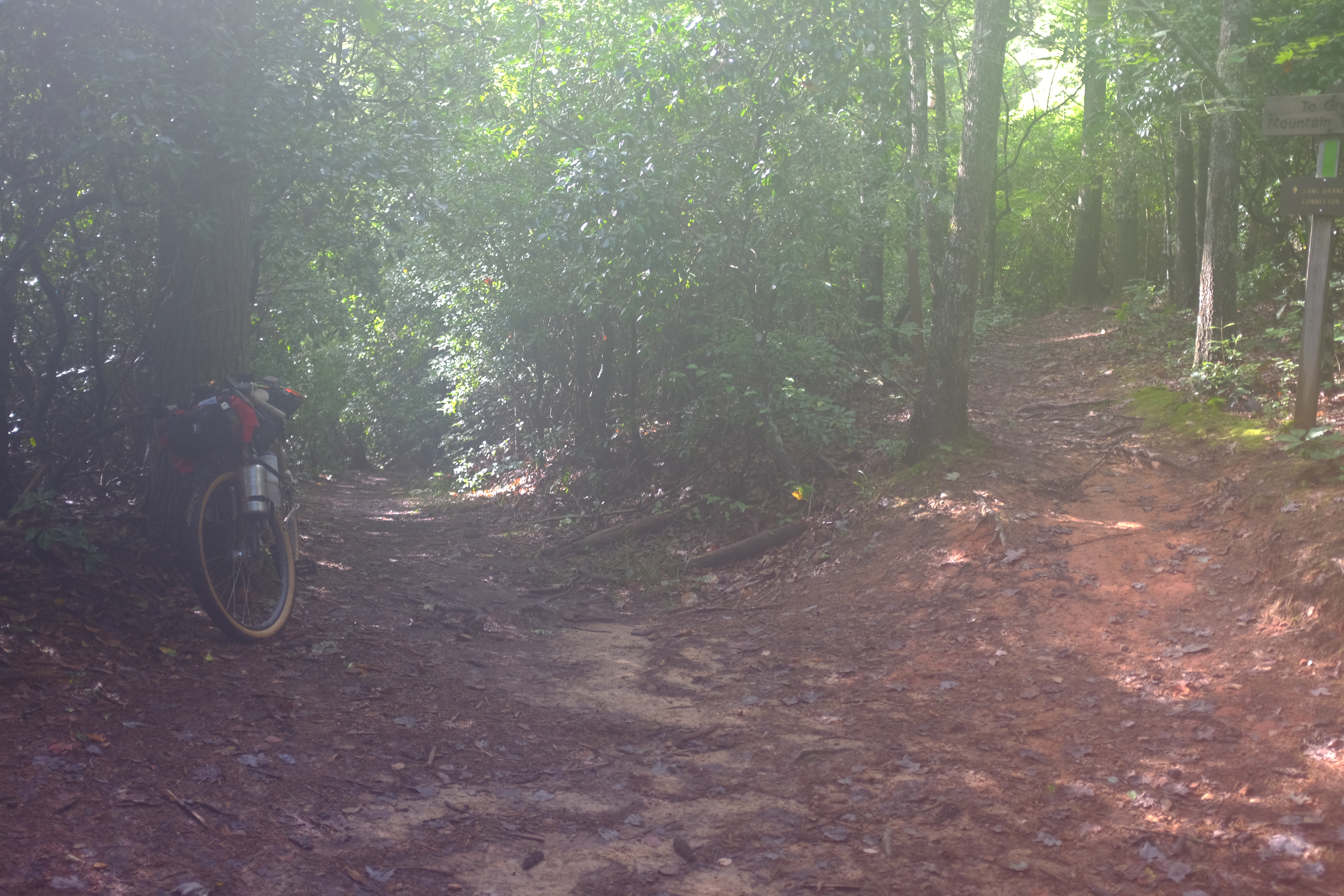
There’s a little bit more descending from the cemetery, and then it’s back to singletrack. After about 3 miles, the trail finds the northern terminus of the Pinhoti trail. The route, with very little deviation, stays on the Pinhoti from this point, all the way to Alabama, some 164 miles later.
Looking at the elevation profile of the course (as a whole), the next 40 miles looked like they’d be relatively easy. In fact, that was the topic of conversation around the gravestones that morning. Everyone seemed to think that all of the hard stuff was passed. That turned out to be the lie of the day.
About halfway from where I started to where the trail becomes flat roads into Dalton is Mulberry Gap. About a half mile (a very steep half mile) off route is race headquarters, the Mulberry Gap Mountain Bike Get-a-way. This is one of the easiest spots for most racers to drop out of the race. Since the Get-a-way provides shuttle service to the start, most racers have parked their car here, so it’s very easy to show up, have some food, take a shower, and eyeball your plush bucket seats, climate controls and internal combustion engine. This is a big reason I didn’t take the shuttle, no temptation.
The twenty mile ride into Mulberry took 4 hours. I stopped at the Get-a-way and had several sandwiches, a coke and loaded up on some food that I would actually be able to eat (salty instead of sweet, mushy/gummy instead of chewy/hard) and some drink mix powders so I’d be able to get some liquid calories.
In total I stopped for 3 hours here. I was offered laundry services and a shower by the sweet sirens who run the place, both of which I declined. Looking at the route, I figured that the next twenty miles were going to be like the last and take me about 4 hours, after that it was about 20 miles of flat paved roads into Dalton, where I knew I could get a meal and hotel (I could, but I knew I shouldn’t).
Riding the roads at night wouldn’t be a problem, I’d be able to get enough speed to keep my headlight super bright, so I just had to time everything so that I’d get off the trail and onto the roads before dark, which meant I needed to leave Mulberry by 4. I came to this conclusion around 3:50, so I squared up for my meal and rolled back up the road towards the trail.
Shortly after I started in the morning my front brake wore down to the backing of the pads. This contributed to the time it took to make it to Mulberry, having lost my back brake on the first day, and now I was without reliable front braking. On top of my braking issues, I was experiencing shifting woes. My derailleur would go up, into an easier gear, but did not want to shift down, into harder gears. This made it very difficult to build and maintain momentum on rolling terrain. The chaotic skipping that would accompany the shifts when they finally occurred also sent jarring shocks into my feet and legs. My left ankle, which is typically my good ankle, was starting to give me signs of distress.
I took some time at Mulberry to swap out my front brake pads and oil all of the pivots on my derailleur to try to bring things back to some type of normal. I abandoned the rear brake. I knew the issue was related to the piston and not the pads and that there was nothing I could do on the trail.
Back to the ride. As expected, the trail away from Mulberry was very steep and contained a good amount of hike-a-bike. There are a few really wonderful gems buried in this part of the Pinhoti. Beautiful, flowy sections of trail that are fun and really lift your spirits. The tragedy is that they are flanked on either side by 6-8 miles of wretched, awful, punishment.
Maybe it was the fresh pads, maybe it was the slightly better working derailleur, or maybe it was the refueled body, but I actually made it to pavement half an hour before I had anticipated.
I had about 8 ounces of water left when I pulled into the first service station from the trail. I walked inside, promptly found a glass bottle of Coke, pointed at the ball of foil behind the glass with the word ‘Hamburger’ written on it in Sharpie, picked up a bag of Lays, and took a seat on the bench outside, wondering if any of my ride companions were hot on my trail.
I whittled away my found half hour, savoring that most-delicious shitty hot-lamp burger. Refilled two of my water bottles, just enough to get me into Dalton, and set out once again.
This is where I knew I would face my ultimate reckoning. Dalton is the only real ‘city’ on the route. It has all of the services. I’d planned on making it there, restocking at the Kroger, and heading up the big climb to a campsite on the Snake Creek Gap trail. This was my plan because I knew that if I could just make it up that climb, just get myself out of Dalton and onto the last bit of trail, I’d finish. If, however, I found something to make me stop in Dalton, the odds of me getting back on the bike would fall into infinitesimality.
I wanted Chik-fil-A.
I knew there was one 100 yards from I-75. I knew after I crossed I-75, there was nothing but suffering and pain. I knew a chicken sandwich on the overpass and another as a reward for making it to camp were total bullshit motivation.
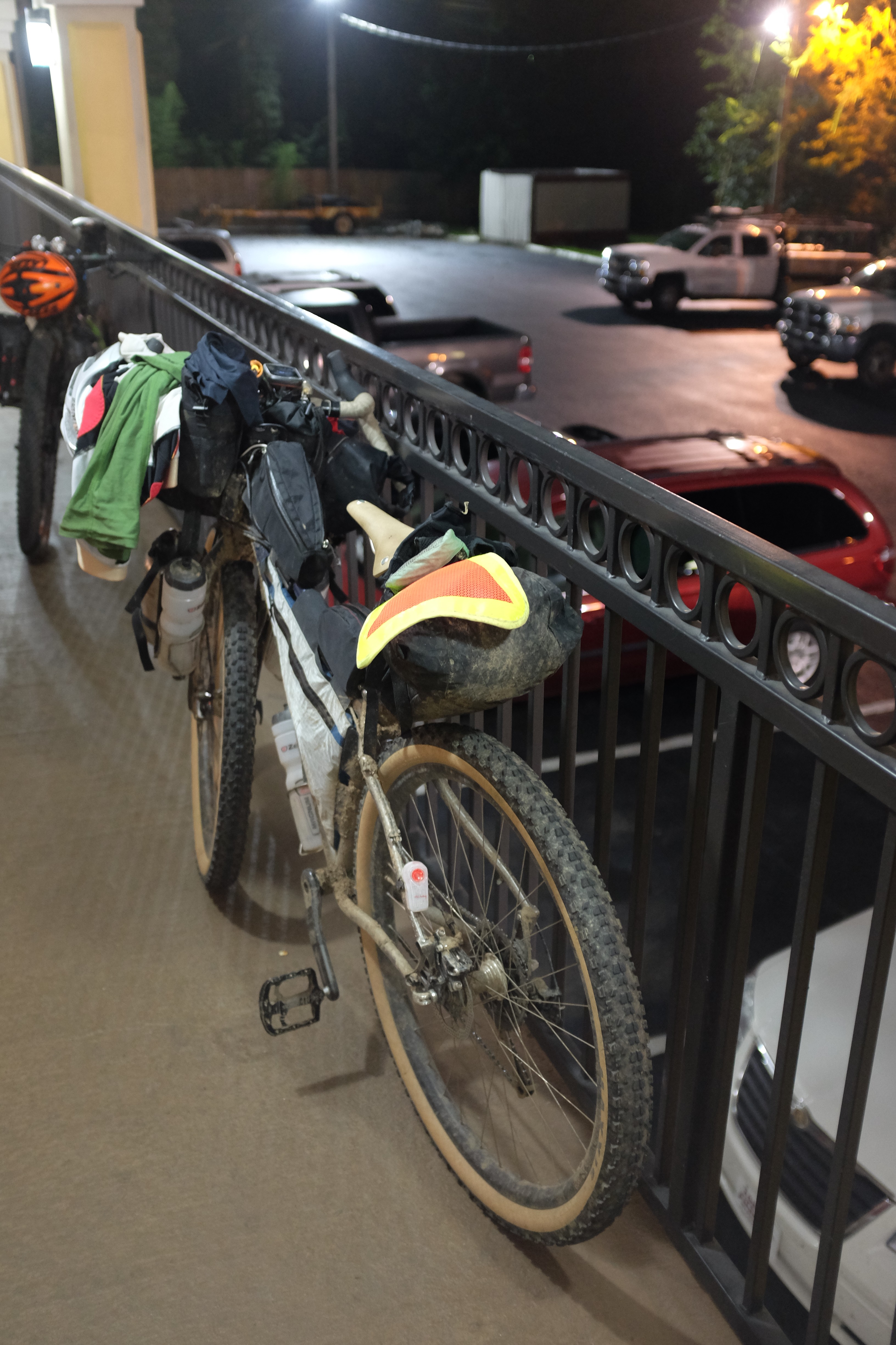
Just as I was looking back to make sure the traffic was clear enough for me to cross the road into the parking lot to purchase a couple of hate-sandwiches, I heard a whistle. Not quite a catcall coming from the side of the road I was already on. It was coming from the second floor breezeway of the Days Inn. Coming from one of the guys who’d been on the pews at the cemetery the night before.
I turned right instead of left.
He came down, said they had gotten a room and a couple of pizzas and invited me up.
Pizzas. Room… Shower… Pizzas…
Sold.
I hauled the bike up the steps, and parked it on the railing outside one of the rooms. Went in, and was immediately greeted with a slice of pie and welcoming conversation. After a few minutes to catch my thoughts, I decided to ask to use their shower. “go right ahead man!” I grabbed a towel, shut the door and started to get the stinky, sweaty, muddy clothes off of me.
When I got down to the shorts I knew it wouldn’t be pretty. I wasn’t expecting however to leave so much of me in my shorts.
Now with two open sores, I hopped in the shower and proceeded to bite my fist as the water washed all of the salt and dirt down my back and across the nexus of pain. After the longest five minutes of the race, I shut the water off and patted myself dry for the first time in 3 days.
I knew those shorts were not going back on. I knew this far and no farther would I go.
Ride stats: 74 miles, 9,000 ft, 14 hours
Total: 260 miles, 35,000 ft, 43 hours
Unfinished: 80 miles.
The Aftermath [Day Four]
I had crashed on the floor of the hotel room the night before. The guys I was staying with set their alarms for 5:30 so they’d be up in time for 6am breakfast and 7am departure.
I went down to the lobby, made a waffle and a cup of coffee, and watched them head off up the hill towards the finish. The sun wasn’t up yet, and even though the route looks easy on the profile from this point (lie of the day), I knew they would be riding until the sun went back down before they made it to the border.
I hobbled my way towards what turned out not to be a coffee shop, and finally settled on waiting at a Burger King for my rescue ride back home.
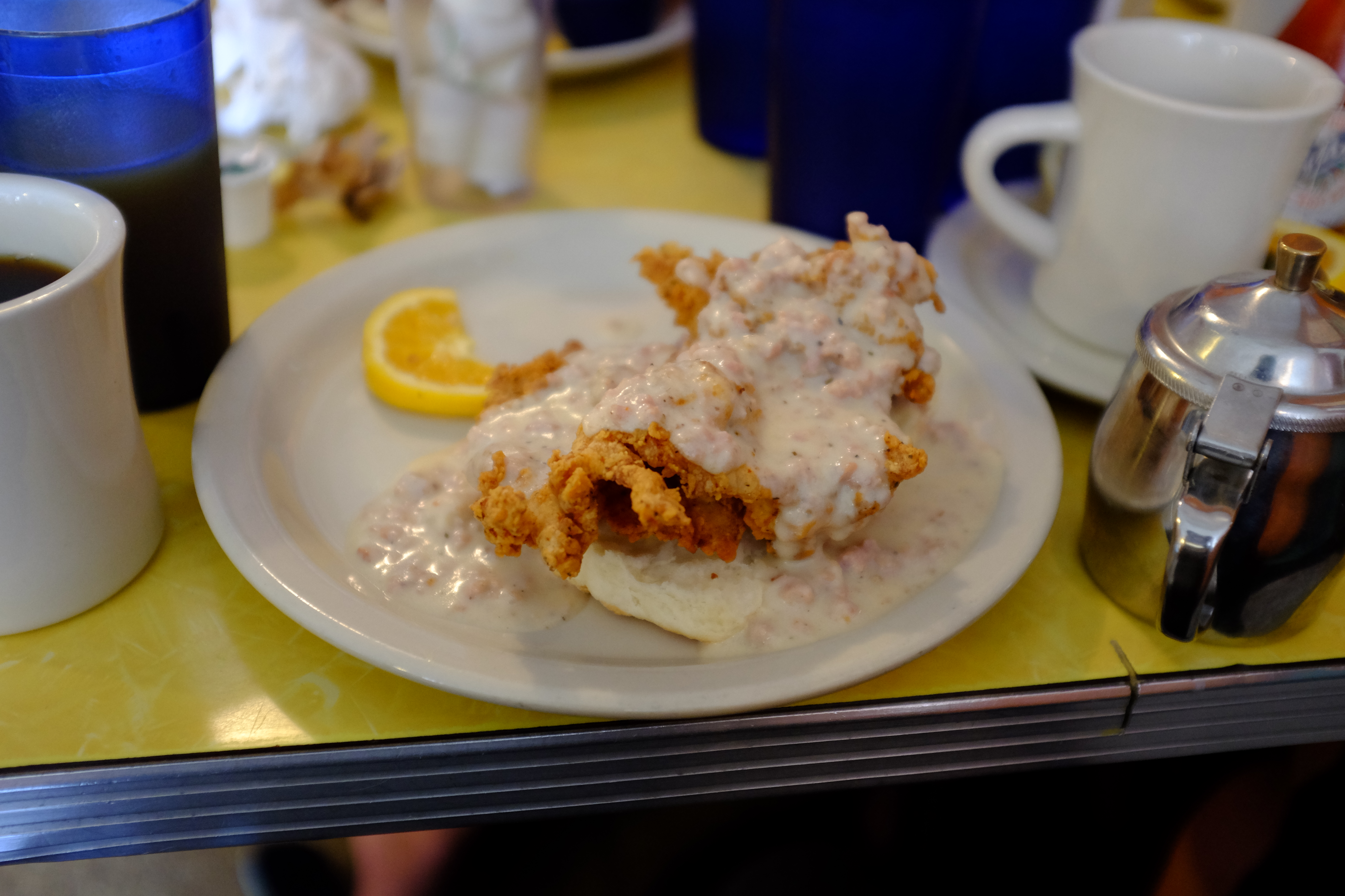
Once back in town, I took another quick, slightly less painful, shower and we went to the local breakfast joint for some real comfy food.
I made a lot of mistakes with this ride, and with each day I identify more. This was the first ride/race I’ve had to pull out of for reasons other than mechanical failure of my bike. It may not be the last, but maybe I’ll be able to keep from repeating these mistakes again.